That’s why, CAGRD created the Membership Locator tool several years ago. By entering information such as an address, subdivision name or cross streets, the Membership Locator quickly determines membership status.
In addition, the tool provides information on how a user can contact their water provider, conserve water and even estimate the CAGRD replenishment assessment. If you find you are located in the CAGRD, your membership category determines how your replenishment assessments are paid, either through your property taxes (for Member Lands) or your water bill (for Member Service Areas).
Since the Membership Locator was released, things have evolved in the water world. Key programs such as the Alternative Path to Designation of Assured Water Supply (ADAWS) have been developed and implemented. And so, the Membership Locator has been updated to keep up with the changing times.
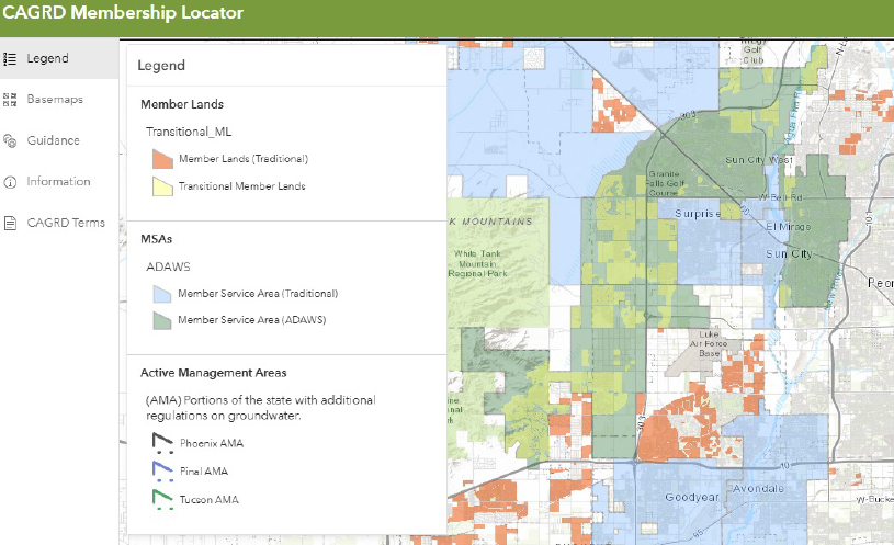
The Membership Locator now includes information about ADAWS Member Service Areas and Transitional Member Lands. Transitional Member Lands are subdivisions that originally enrolled under their own 100-year water certificate but are now part of a water provider’s designated service area through ADAWS.
Use the map legend to see where CAGRD members are located or input an address into the search bar to determine membership status. Additional information about ADAWS and Transitional Member Lands can be found in the pop-ups.
Figure 1 – Users can click on the legend to see which colors correspond to CAGRD member statuses.