By Phill Pagels and Scott Bryan, Water Transmission; Jaxon White, Water Systems; and Rachel von Gnechten, Resource, Planning & Analysis
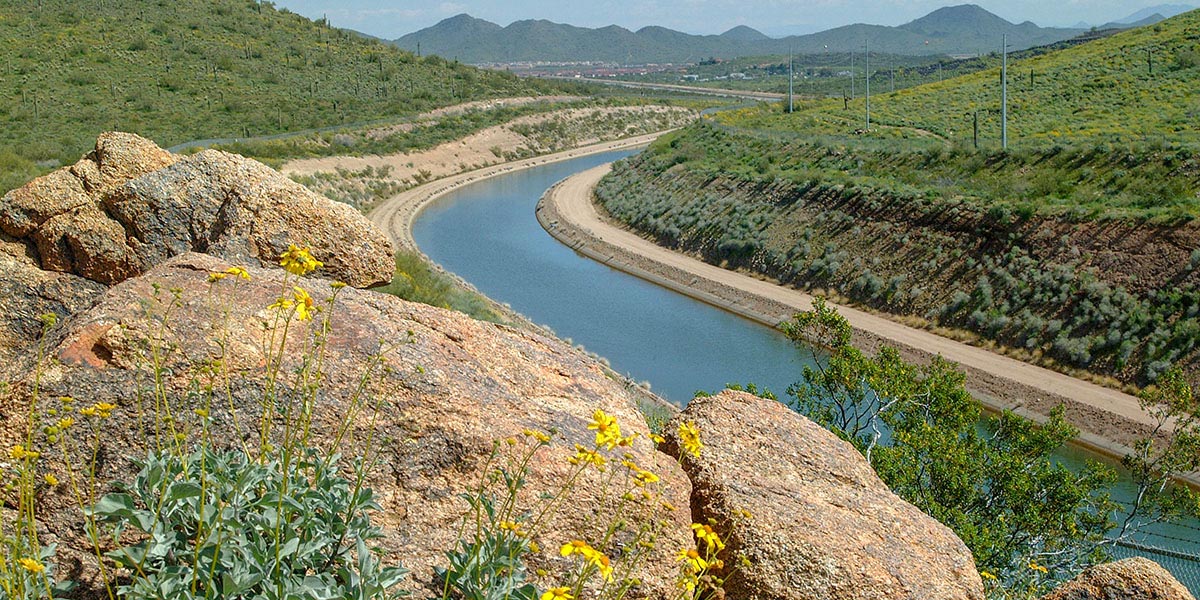
In the world of water, “quality” isn’t just a buzzword – it’s a valuable resource. Every day, the Central Arizona Project (CAP) conveys Colorado River water across 336 miles. And in the future, this same infrastructure may “wheel” non-Colorado River water to partners across the state.
To ensure this diverse mix of supplies – potentially delivered to different locations and at different times via CAP – meets the standards in the Water Quality Guidance Document, CAP has developed the CAWCD System-Wide Water Quality Model.
The CAWCD System-Wide Water Quality Model doesn’t just look at a single point – it simulates the entire journey. By tracking the water from its source at Lake Havasu, the model simulates every mile of travel, calculating the chemical and physical changes along the way.
To achieve this, the model uses:
- Physical parameters: It incorporates CAP geometry changes and elevations that influence flow and settling.
- Environmental tracking: The model uses five meteorological data zones that process real-time variables including air temperature, dew point, wind speed, cloud cover and solar radiation.
The Lake Pleasant variable: Our system “truck stop”
If the canal is the highway, Lake Pleasant is the system’s massive “truck stop” where the water is diverted to pick up extra fuel and refresh! The model is specifically designed to account for Lake Pleasant’s unique operational cycle.
- Fill season (spring/fall/winter): During these months, CAP takes advantage of lower energy costs to pump “fresh” Colorado River water into Lake Pleasant.
- Release Season (summer): When Arizona’s water demand peaks, the flow is reversed. Water stored in the lake is released back into the canal to supplement the river supply.
This “fill and release” cycle is a core component of the model. Water that has been stored in the lake can have a different profile than the water coming straight from the river, as it is influenced by depth, temperature and evaporation. The model seamlessly integrates these seasonal shifts, ensuring that the blend accounts for changes throughout the year.
Mapping the monthly delivery: Every turnout counts
The true power of the model lies in its ability to incorporate historic use variability to model the cumulative water quality effects. By using monthly delivery schedules, we can model how much water will be delivered to each turnout from central to southern Arizona.
The model calculates how those specific volumes -could affect the canal’s overall chemistry as new sources are introduced into the CAP.
It considers:
- Flow velocity: How fast the water is moving based on the total monthly demand
- Retention time: How long the water stays in the canal or the lake
- Turnout specifics: Exactly when and where a city, tribe or irrigation district will pull water from the system
Transparency in real-time: The AquaPortal
CAP doesn’t keep this data in a black box. The results of model estimates of various water blends at every turnout are uploaded to AquaPortal, CAP’s interactive online data platform, where the public can not only view the model results, but also explore all of CAP’s historical water quality data. You can learn more about AquaPortal here.
KRA: Water Supply
Providing a reliable CAP water supply for the short- and long-term